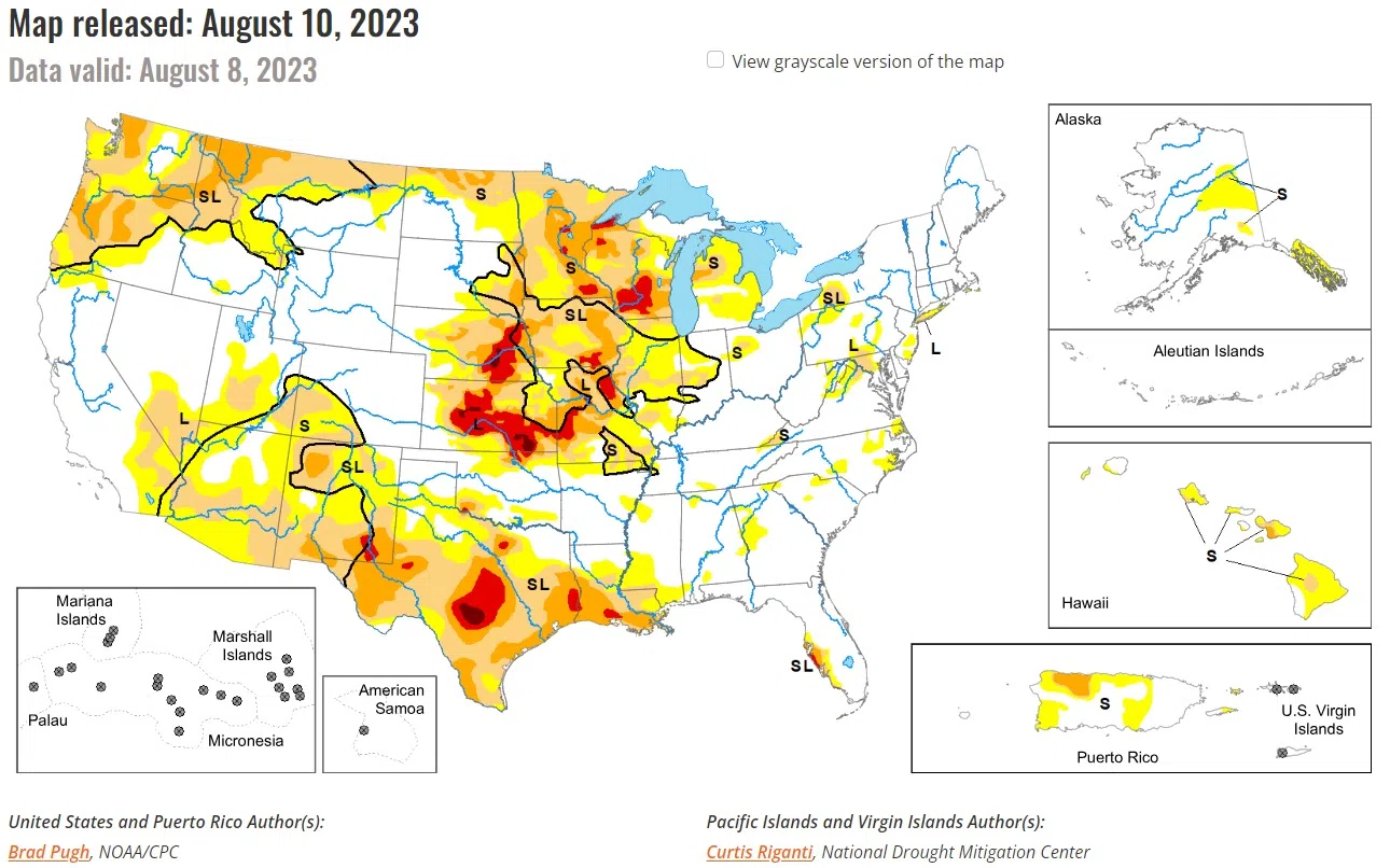
According to this morning’s U.S. Drought Monitor update, during the first week of August, parts of Missouri received 5 to 10 inches (locally more) of rainfall. The wet start to August resulted in improving drought across parts of the Corn Belt. Farther to the north, drought continues to intensify across Wisconsin. On August 7, a severe weather outbreak with heavy rainfall affected the East. Short-term drought expanded this past week across parts of the Hawaiian Islands.
Above normal precipitation since the beginning of July and a lack of support from the long-term indicators led to a 1-category improvement to west-central Nebraska and bordering areas of Kansas. Recent beneficial precipitation also resulted in improving conditions across parts of the Dakotas and Wyoming. Short-term drought was expanded across northeast North Dakota which remained to the north of the storm track. The lack of Monsoon rainfall this summer resulted in the addition of short-term drought to southwestern Colorado.
In the Midwest, heavy rainfall (2 to 8 inches, locally more) during the first week of August prompted widespread improvements to Missouri, southern Iowa, Illinois, and Indiana. A few 2-category improvements were justified across Missouri and Illinois where more than 6 inches of rainfall occurred and there was support from the short to long-term indicators.
Despite widespread, heavy rainfall (more than 1.5) across western Iowa this past week, improvements were limited given the longer-term drought indicators and a reassessment can be made in subsequent weeks. Severe (D2) to extreme (D3) drought was expanded across Wisconsin based on continued dryness dating back to the late spring. Exceptional (D4) drought was added to northern portions of Douglas and Ashland counties in northern Wisconsin. Superior has received 4.71 inches of rain since May 1 which is the driest on record.
National Drought Mitigation Center
University of Nebraska-Lincoln